Catalog Archive
Auction 118, Lot 348

"Grondvlakte van Nieuw Orleans, de Hoofdstad van Louisiana [on sheet with] De Uitloop van de Rivier Missisippi [and] De oostelyke Ingang van de Missisippi, met een Plan van het Fort, 't Welk het Kanaal Beheerscht", Tirion, Isaac

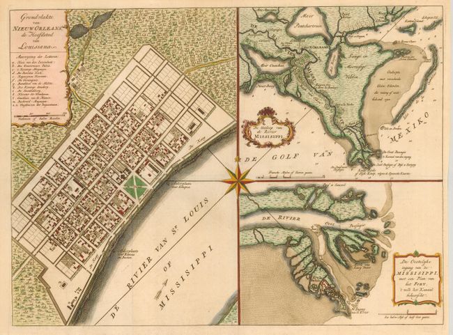
Subject: Louisiana, New Orleans

Period: 1769 (published)

Publication:

Color: Hand Color

Size:
17.6 x 13 inches
44.7 x 33 cm
Download High Resolution Image
(or just click on image to launch the Zoom viewer)

This handsome sheet consists of three maps composed around a large compass rose. This is Tirion's version of the map first drawn by De la Tour in 1720, only two years after the founding of New Orleans. The first is a plan of the city of New Orleans (now the French Quarter) vividly depicting its protective canal, barracks and quays. The second is a map of the vicinity of New Orleans including the delta and surrounding bayou. The third is a map of the location of Fort la Balisle at the mouth of the river, which sank into the marsh in the late 1700's. Each map has a delicately engraved title cartouche.

References: Goss (NA) #63; Van Ermen #39.

Condition: A+

Issued folding, now flattened.

Estimate: $750 - $850

Sold for: $850

Closed on 3/6/2007

Archived