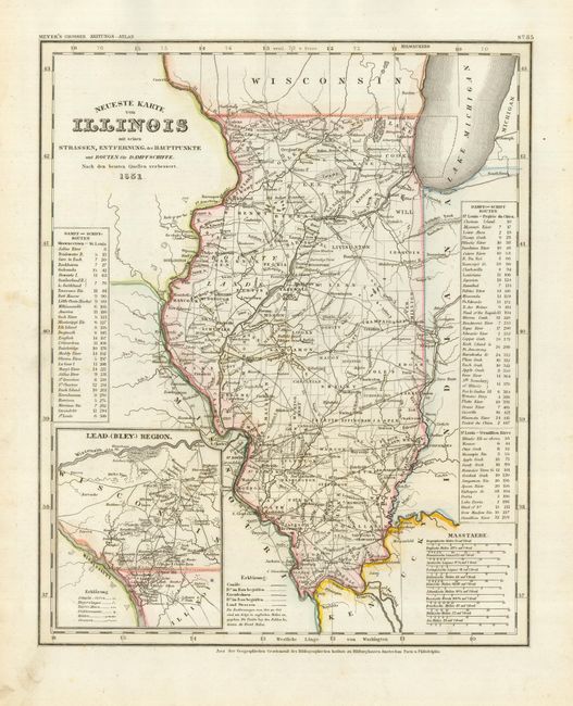
Subject: Illinois
Period: 1851 (dated)
Publication: Grosser Zeitung Atlas
Color: Hand Color
Size:
11.8 x 14.5 inches
30 x 36.8 cm
This is the German edition of the Tanner/Mitchell Illinois map from the New Universal Atlas, with a German title but English place names. This edition is from Meyer's Grosser Zeitung Atlas, published in 1853 or later. Tables at both side give steam boat routes and mileages from Shawneetown to St. Louis, and from St. Louis to Prairie du Chien and the Vermillion River. The map is inset at the left with the Lead-(Bley)-Region, noting the lead mining districts in southwest Wisconsin and northeast Illinois along the Mississippi River. Illinois is shown with 99 counties as compared with 102 at present.
References:
Condition: A
Original outline color. Marginal toning and soil, else fine.