Subject: Colorado
Period: 1906-20
Publication:
Color: Printed Color
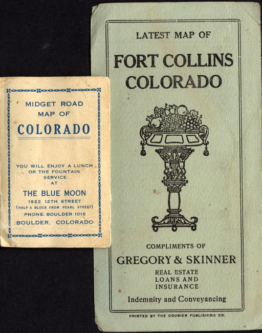
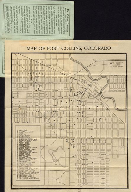
The first map is a folding pocket map titled "Map of Fort Collins, Colorado." This scarce advertising issue was published by Courier Publishing Co. for Gregory & Skinner, Real Estate, Loans, and Insurance. Indemnity and Conveyancing. Circa 1906-1910, 13" x 12", folding into paper (3.3" x 6.3") covers titled "Latest Map of Fort Collins Compliments of Gregory & Skinner…" The map extends from Elm Street in the north south to Prospect Street. At upper right is the Cache la Pourde River with the Great Western Sugar Co. on the far shore. A table locates and names 51 important buildings including banks, government buildings, churches, schools, and more. The inside cover extols the benefits of Fort Collins with information on the climate, facilities and services, including the State Agricultural College where the "tuition in all courses and sciences is free." The back cover has more ads for the same company.
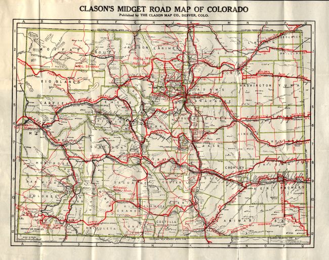
The second is a wonderful ephemeral advertising map published for the Blue Moon in Boulder. The map is "Clason's Midget Road Map of Colorado," published in Denver by the Clason Map Co., circa 1920. The map unfolds from tiny 2.25" x 3.25" paper covers to 10.8 x 8.8". Considering its size, the map is remarkably detailed. It features red overprinting to show principle routes including Pikes Peak, the Lincoln Highway, Golden Rod Highway, Dallas Canadian Denver Highway, and many more. The paper cover is titled the same as the map and continues "You will enjoy lunch or fountain service at the Blue Moon 1922 12th Street (Half a block from Pearl Street)…Boulder, Colorado." The Clason Map Company was a pioneer in the production of maps to meet the growing demand of automobile enthusiasts. The existing bicycle and railroad maps did not well serve this new form of transportation and maps were needed to identify roads suitable for automobiles; roads with adequate gravel, bridges, gasoline and repair shops, etc. In 1905 the American Automobile Association produced the first maps specifically for automobiles and George S. Clason quickly followed suit compiling maps with the assistance of local automobile clubs. We find no references to this obviously scarce pair of advertising pocket maps.
References:
Condition: A
The first map is a nice, clean example with some short marginal fold splits, closed on blank verso with archival tape. The second map is near fine with one short marginal fold split, closed on verso with archival tape. Paper covers with slight toning and one small loss on back at bottom, not affecting front with title.