Subject: California
Period: 1853 (dated)
Publication: Railroad Surveys
Color: Hand Color
Size:
16 x 22.2 inches
40.6 x 56.4 cm
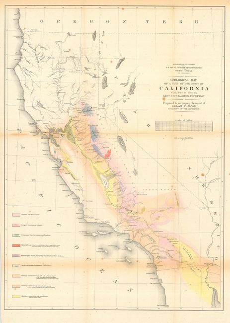
Colorful map of California covering the entire state, with a majority of the map hand colored to reflect geological knowledge. These regions are color-coded in accordance with a legend at the left side of the map. The legend gives the locations for nine geological types as mapped by Lieut. R.S. Williamson of the Topographical Engineers. Interesting details throughout, and especially along the American River. Shows a huge Mono Lake with Lake Tahoe not shown; rather in its place is a small lake named Lake Bonpland. In Southern California, Los Angeles, San Gabriel, San Pedro, and more are located. Interestingly, the water between San Pedro and San Diego is called "Earthquake Bay." Prepared to accompany the report of William P. Blake, Geologist of the Expedition. Lithographed by Sarony, Major & Knapp of New York.
References:
Condition: B
With scattered foxing, and some toning along a couple folds. Original color, very fine impression and full, original margins.