Subject: California
Period: 1850 (circa)
Publication: Senate Ex Doc. 47, Maps 3 & 7
Color: Black & White
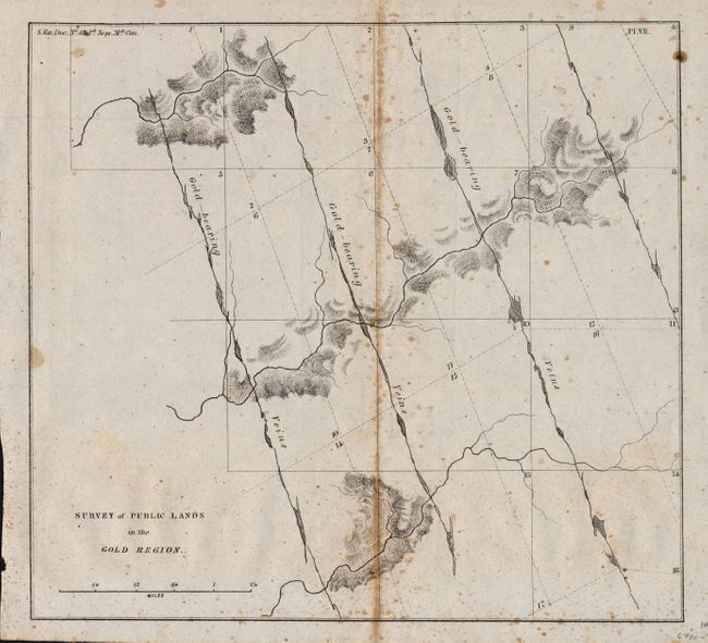
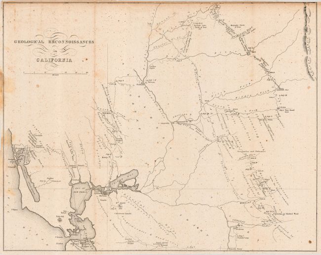
Nice pair of California Gold Rush period maps. The first (8.5 x 8") shows township lines overlaid with diagonal lines indicating gold bearing veins. The second map, by Philip T. Tyson (14.8 x 11.8"), is a generalized map of the geology of the central California region east and north of San Francisco Bay. It extends to the Sierra Nevadas and names many gold regions: Mormon, Coloma, Spanish Bar, and many areas simply marked GOLD. There is much of interest, including the Emigrant's Road to Salt Lake, the City Wagon Road from Suter's (sic) to Dater's, the location of several fossil beds, numerous named gold camps, ferries, and much more.
References: 2) Wheat (Gold) 179; Howes (US) T455
Condition: B
Both issued folding, now pressed. The former with some toning along centerfold, the latter with some toning at left and along top edge with two short tears. Both with light, very small, foxing spots.