Subject: United States - Northwestern
Period: 1890 (published)
Publication:
Color: Printed Color
Size:
34 x 31.5 inches
86.4 x 80 cm
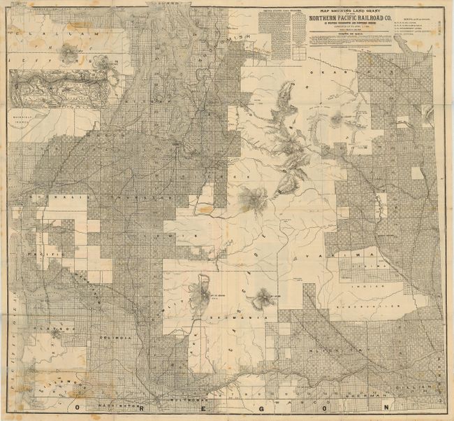
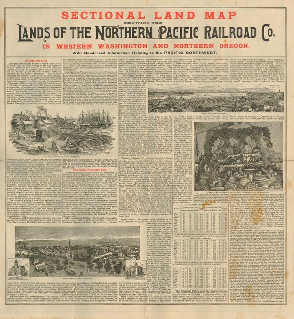
This is a scarce land promotion broadside, published by the Northern Pacific Railroad. On one side is the large "Map Showing Land Grant of the Northern Pacific Railroad Co. in Western Washington and Northern Oregon. Corrected up to April 1, 1890." The map occupies the entire side (34" x 31.5") and features very fine detail throughout the region. It extends from the Pacific Ocean eastward to Ellensburg and beyond to Port Eaton. The city of Portland is in the south and the map continues north up to the Strait of Juan de Fuca. Port Townsend, Port Angeles, Seattle, Astoria, and more are located. The map describes the terms of sale including the maximum number of acres one person may purchase, the terms and price ($2.60 - $6 per acre). The forty and fifty mile limit lines for the railroad are shown. The legend identifies railroad lands available and those already sold - no doubt to create a sense of urgency.
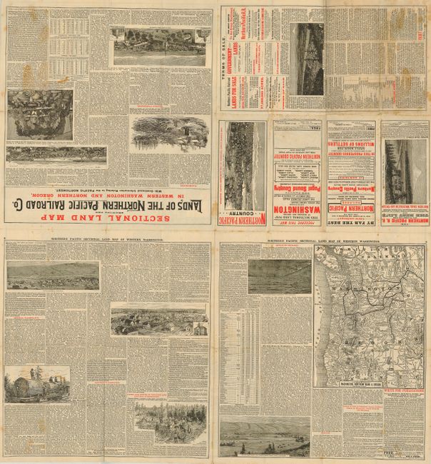
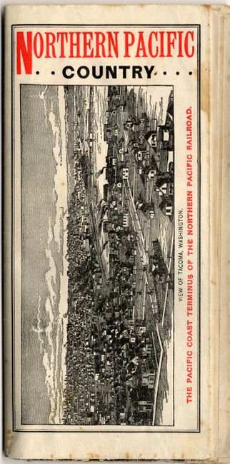
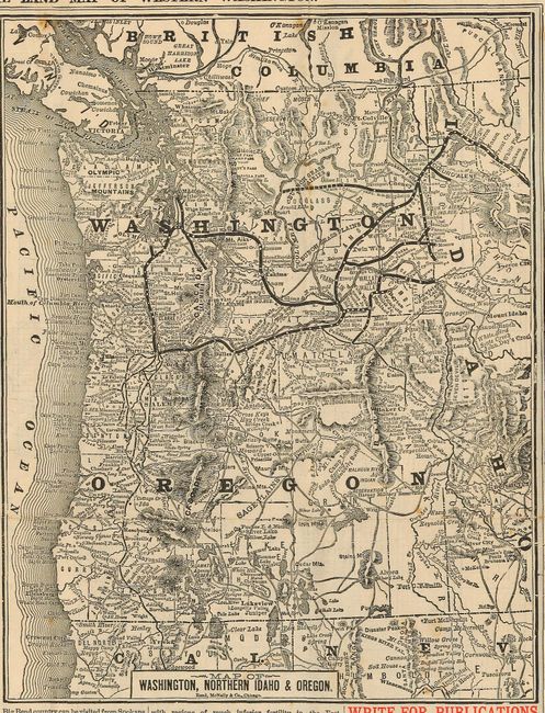
The other side is filled with marketing and promotional information and images. A second map "Map of Washington, Northern Idaho & Oregon" (8.2" x 11") has bird's-eye views of Puyallup, Ellensburg, Portland, Seattle, and North Yakima. Self-folds into two-color covers with bird's-eye views of the Hotel Tacoma with Mt. Rainer figuring prominently in the background, and another showing Tacoma from the terminus of the Northern Pacific Railroad yard at Puget Sound. A scarce and ephemeral land promotion railroad broadside.
References:
Condition: B
Some light scattered foxing or staining, some folds with splits mostly confined to margins, closed with archival tape. Folding, as issued.