Subject: United States - Northwestern
Period: 1873 (published)
Publication: Gray's Atlas of the United States
Color: Hand Color
Size:
14.8 x 12 inches
37.6 x 30.5 cm
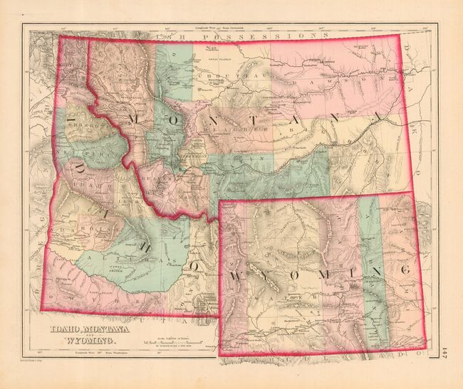
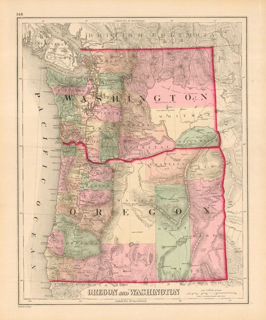
This fine lithographed map is beautifully drawn and filled with information, including many place names, forts, and detailed watershed and topography. Wyoming has five counties: Uintah, Sweet Water, Carbon, Albany, and Laramie. The Union Pacific is shown in the south with all stations named. The newly formed Yellowstone Park extends slightly into Montana and Idaho and is here called the "Proposed National Park." Montana names just eleven counties, the largest being in the lightly settled eastern reaches. Idaho has ten named counties. There are numerous mining areas located throughout the map. An equally fine and well drawn map of Oregon and Washington is on the verso.
References:
Condition: A
Near fine example with terrific original coloring, full margins, and crisp impression.