Subject: United States - Western
Period: 1854-57 (dated)
Publication: U.S. Pacific Railroad Surveys
Color: Black & White
Size:
45.5 x 41.5 inches
115.6 x 105.4 cm
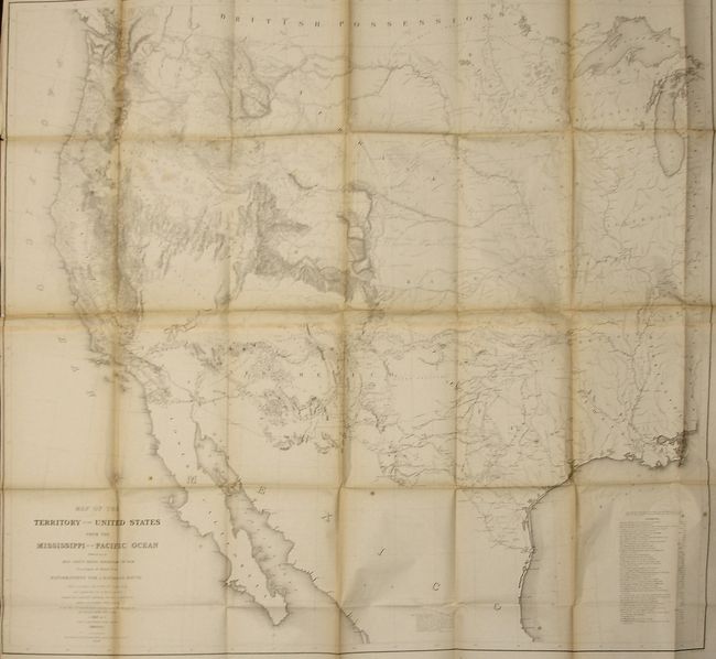
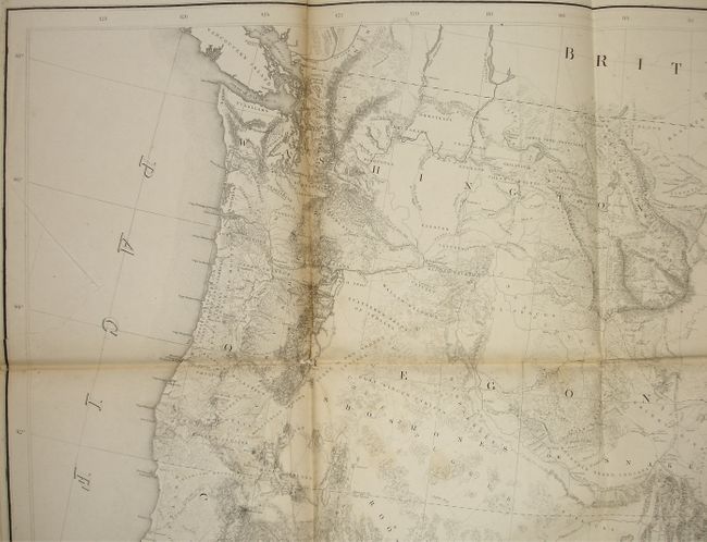
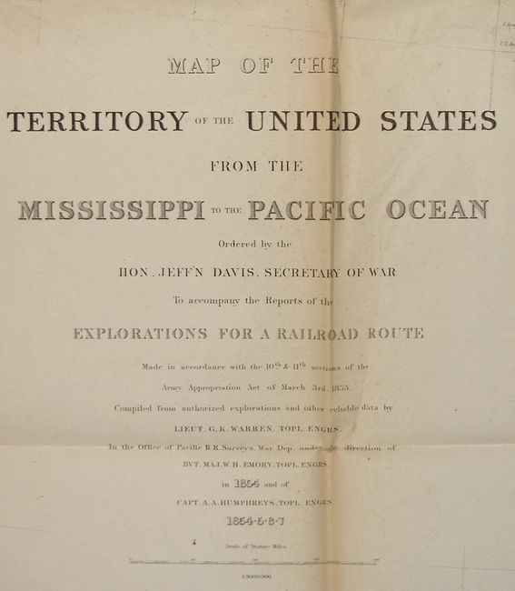
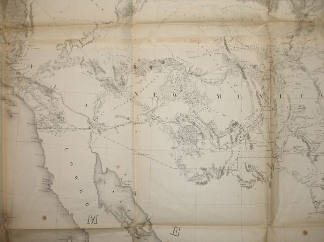
Known as "Warren's General Map," this is a monumentally important map that is considered to be the first accurate overall picture of the region. Wheat considered it so important that he dedicated eight pages to its description and called it the most important map produced by the Topographical Engineers. Drawn on the polyconic projection, the map culminated a half-century of government explorations beginning with Lewis and Clark. Only 24 years old when assigned the task, Warren used information from the U.S. Land Office, the Coast Survey, Topographical Engineers, the Adjutant General, the Quartermaster General, the Indian Bureau, and Smithsonian Institution to obtain the latest information in developing this map. The majority of the map was completed by 1854, but it was not fully complete when the first railroad survey report was published in 1855 and thus did not accompany all editions. A remarkable and scarce map that represents the best geological knowledge of the day
References: Wheat (TMW) #936.
Condition: B
Folding, as issued. A sound example less some fold toning, one short closed tear at binding trim that enters the Pacific, and a little fly specking along a fold at right.