Subject: Colonial Southeast
Period: 1647 (circa)
Publication:
Color: Hand Color
Size:
20 x 15 inches
50.8 x 38.1 cm
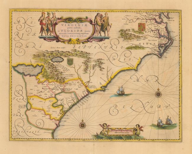
Lovely map of the Southeast extending from the southern part of Virginia to northern Florida. This is the first state of Jansson's map, which is virtually identical to Blaeu's map of 1638. Cartographically it improves on the Hondius map of 1606, on which it was derived, with Chesapeake Bay correctly indicated as a large bay and the Carolinas and Georgian coasts depicted more accurately. The map presents the English and French colonial interests in the region as depicted by their respective royal arms. At the southern end of the Appalachians is a note concerning gold and silver mines. Richly decorated with a large cartouche flanked by Native Americans. The Atlantic Ocean contains two compass roses, three sailing ships and two aquatic putti holding the German scale of miles. Latin text on verso.
References: Burden #254; Cumming (SE) #42; Van der Krogt (Atlantes) #9400:1B.
Condition: B
Nice old color with light toning. Centerfold split at bottom closed with old paper repair on verso.