Subject: United States - Southern
Period: 1820 (dated)
Publication: New American Atlas
Color: Hand Color
Size:
22 x 27 inches
55.9 x 68.6 cm
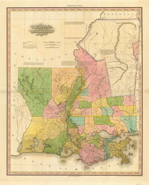
This large map provides excellent information on Louisiana and the young state of Mississippi. There are only 26 parishes in Louisiana and 16 counties in Mississippi. The recent Choctaw Purchase in west central Mississippi was added to this second state of the map, reflecting the acquisition of territory through the Treaty of Doak’s Stand. The northeastern part of the state is still in the hands in the Choctaw and Chickasaw Indians, except for a sliver along the eastern border that was organized as Monroe County in 1821 from the Chickasaw Cession of 1816. The map is presented on a scale of 1:940,000 and shows detailed physical features as well as boundaries, cities, towns, villages, post offices, roads, canals, and Indian Agencies. There are many interesting legends and notations throughout the map. This is the second state, which was published in the first collected edition of the atlas in 1823.
Henry Tanner's American Atlas was the one of the most important atlases published in America during the nineteenth century. The maps were carefully compiled from the most recent surveys, and were finely engraved and carefully hand colored. Because of the great expense involved in the production and publication, the atlas was initially published in five parts between 1819 and 1823. The first complete edition appeared in late 1823 with subsequent editions until 1839.
References: Phillips (A) #4462; Ristow pp. 191-200.
Condition: A
Lovely original color with a bit of faint offsetting and toning along centerfold, still overall very good.