Subject: Southern United States
Period: 1814 (circa)
Publication:
Color: Hand Color
Size:
9.5 x 7.7 inches
24.1 x 19.6 cm
Mathew Carey was a seminal figure in early American publishing; establishing the first publishing firm to specialize in cartography and issuing the first atlas devoted exclusively to American maps. He set up an elaborate cottage system of craftsmen for compiling, engraving, printing, and coloring maps. This practice was emulated by later American cartographic publishers such as John Melish and Henry S. Tanner. The American Atlas concept was also adopted by other publishers in both the United States and Europe.
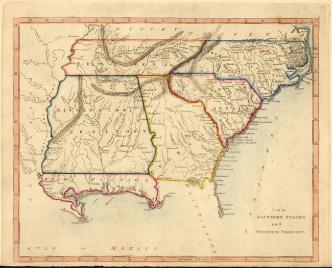
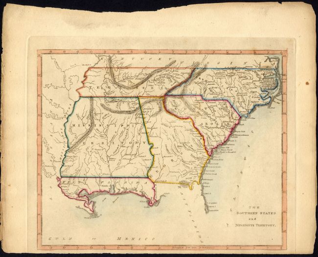
This is a scarce map that covers current-day Tennessee, North Carolina, South Carolina, Georgia, Alabama, Mississippi and northern Florida. The oversized Mississippi Territory includes today's Alabama, thus stretching to the Mississippi River. The Florida Panhandle is designated as West Florida, while the area west of the Mississippi River is Louisiana. Lovely delicate coloring.
References:
Condition: A
The plate is printed off center favoring the bottom of the paper and leaving a narrow lower margin. Nice original hand coloring on thick paper with original margins.