Subject: Colonial South
Period: 1778 (circa)
Publication: Atlante Novissimo
Color: Hand Color
Size:
16.5 x 12.5 inches
41.9 x 31.8 cm
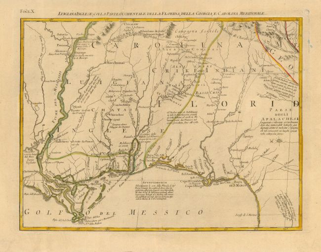
This map is a great regional map that shows New Orleans and details the Gulf Coast to Florida, and the valley of the Mississippi River north above Akansa and Po. Ozier. It also depicts Mobile Bay and the course of the Albama river and tributaries. The prominent trading route in the north nearly reaches the Mississippi River and even marks distances between important points. The map extends to show the region of Capo S. Biagio and the course of the Apalachicola River. The map is sheet X from Zatta's Le Colonie Unite dell' America Settentrle, and is often referred to as the Italian edition of John Mitchell's map, on which it is based. Zatta's maps retain Mitchell's scale, but being smaller are more legible. Zatta also included updated legends (in Italian) with notations concerning the Revolutionary War.
References: Portinaro & Knirsch #152; Sellers and Van Ee #163.
Condition: A
Original outline color. Printer's crease at left, else fine.