Subject: Colonial South
Period: 1713 (circa)
Publication:
Color: Black & White
Size:
15.3 x 10.3 inches
38.9 x 26.2 cm
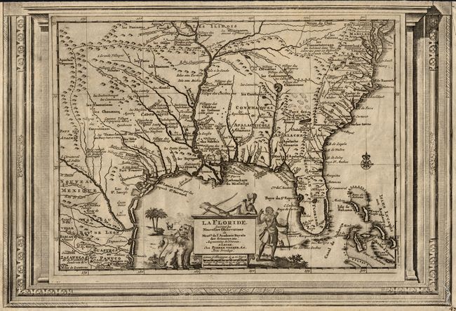
This splendid map of the southern United States was based on Delisle's influential "Carte du Mexique de la Floride…" of 1703. The map is filled with details of early colonial settlements and Indian tribes. A reduced version of the large lake that was first shown on Le Moyne's 1591 map is shown with the label Lac Grande. The Apalachicoli River flows from another large lake in present day western Georgia. Details of the Bahamas are included. The Gulf of Mexico is filled with a large cartouche featuring Native Americas and an incongruent lion. The map is enclosed in a frame-like border.
References: Cumming (SE) #155.
Condition: B
Dark impression printed on evenly toned paper. The top border is trimmed, as this map was originally printed with another map sharing that part of the border. A worm track in lower right corner that has been filled.