Subject: Colonial Mid-Atlantic
Period: 1671 (circa)
Publication: De Nieuwe en Onbekende Weereld…
Color: Hand Color
Size:
13.8 x 11.3 inches
35.1 x 28.7 cm
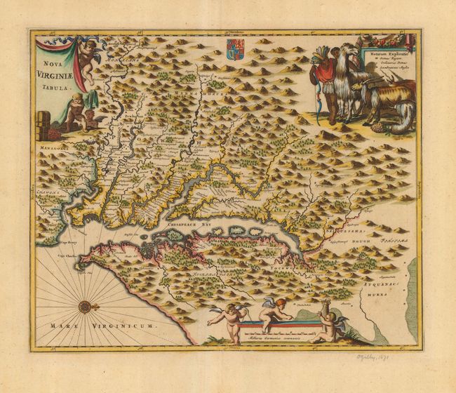
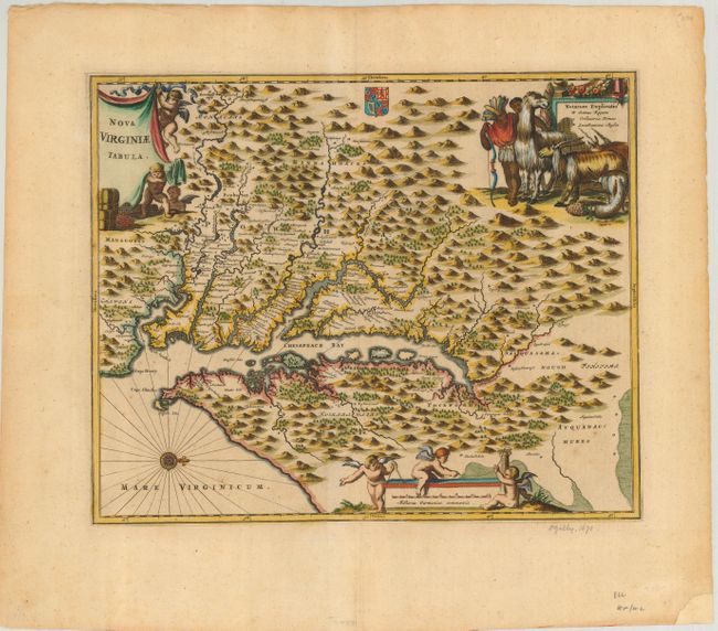
This is a very attractive map based on the Hondius/Blaeu version of John Smith's prototype map of Virginia and the Chesapeake Bay. It is beautifully engraved with mountains, rivers, and forests. The map provides a wealth of information concerning the Indian villages in the region. The title and distance scale cartouches feature putti and a scene at upper right features Native Americans with some very interesting and exotic animals.
References: Tooley (Amer) p.168-9, plt. 77; Goss (NA) #38.
Condition: A
Very nice impression and wide margins. A small amount of the lower right corner margin has been replaced, not affecting map.