Subject: North America
Period: 1850 (circa)
Publication: Atlas Universel Illustre
Color: Hand Color
Size:
16.8 x 11 inches
42.7 x 27.9 cm
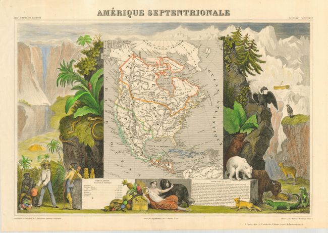
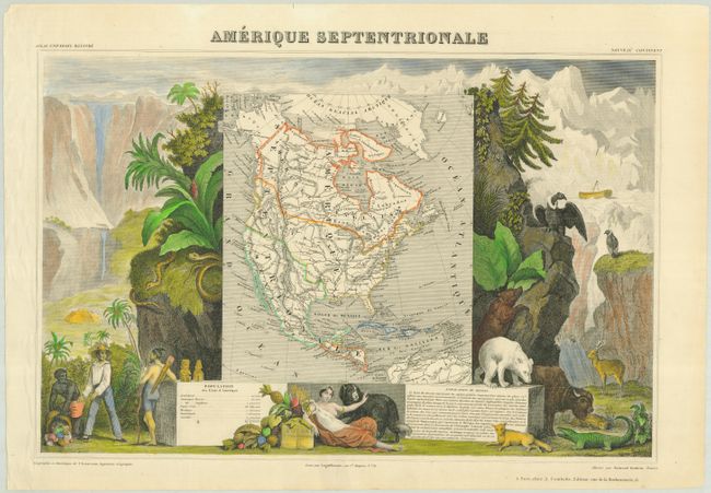
Victor Levasseur's "Atlas National Illustre" and "Atlas Universel Illustre" are among the last decorative atlases published. The maps are all lavishly illustrated with scenes of the countryside, products and activities indigenous to the region.
This very popular and decorative 19th century map features the United States extending into present day Canada, Russia in possession of Alaska, and Mexico's northern border is according to the Treaty of 1819 (mislabeled 1810). The map is surrounded by beautifully engraved, and fully colored, scenes of North and Central America including local animals, a ship stranded in the polar sea, and a Mayan Temple.
References:
Condition: A
Some chipping and a small tear in the upper blank margin. Map has original outline color with fine later color on vignettes.