Subject: North America
Period: 1776 (circa)
Publication: Atlante Novissimo
Color: Hand Color
Size:
16 x 12.3 inches
40.6 x 31.2 cm
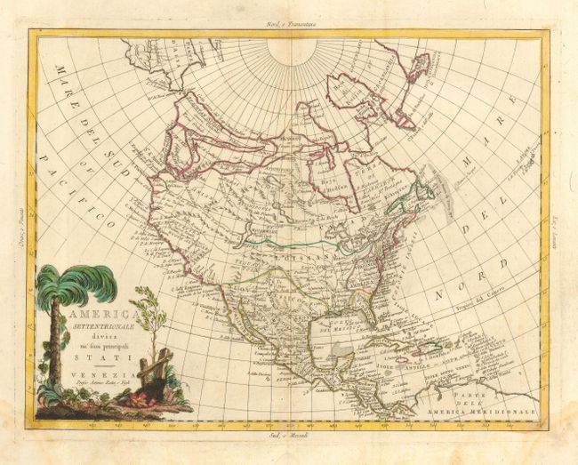
Zatta depicts the western portion of North America with some of the notorious misconceptions popularized by the maps of Delisle and Buache, with a dramatic Northwest Passage flowing from the north of Hudson Bay to Lake Winnipeg and through some very dubious waterways to the Pacific. In roughly the area of Puget Sound, there is a mention of the Chinese colony of Fou Sang, based upon Hui Shen's supposed voyage of 499 AD. The topography shows a phalanx of mountain ranges going erroneously east-west, as well as a number of rivers doing the same. The Bella Riveria F. is shown to connect the Mississippi River to the Pacific. The English colonies are confined to the eastern seaboard and Spain is shown controlling Florida and Georgia. An engrossing map decorated with a wonderfully rendered cartouche.
References: Wheat (TMW) #204.
Condition: B
Lovely impression with original color. Light damp stain at lower left and right corners, just into neatline.