Subject: Western Hemisphere
Period: 1758 (published)
Publication: Kinder Geographie
Color: Hand Color
Size:
11 x 9.3 inches
27.9 x 23.6 cm
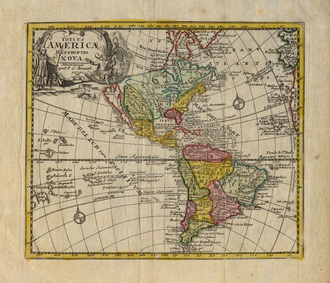
This attractive, scarce map showing an insular California was published later than most maps that show this cartographic myth. Nearly all cartographers stop showing it in this fashion after 1740. The map is rife with older terminology, including Nova Albion in California, which is shown with two bays on the northern coastline per the second Sanson model. Nova Francia and Louisiana take up much of North America, and the Mississippi is depicted wandering too far to the west. N. Mexico sive Nova Granada takes up the Southwest with Santa Fe de Granada as its capital. The title cartouche is decorated with Native Americans and what looks like a seal.
References: McLaughlin # 238.
Condition: A
Original color. Some light, marginal stains, else fine.