Subject: Western Hemisphere & Pacific
Period: 1723 (published)
Publication: Libros Rituales I Monarchia Indiana
Color: Black & White
Size:
12.8 x 9 inches
32.5 x 22.9 cm
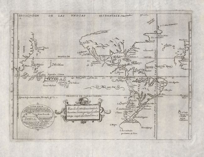
This uncommon map was originally created by Antonio de Herrera y Tordesillas, who was the official historian of Castile and the Indies. He compiled a history of the Spanish conquests and early explorations in the Americas, that included this simple, but elegantly engraved map of the Americas and the Pacific extending to the Spanish interests in the Philippines. Korea is shown as an island and is named here Cory, North America is truncated with a peninsular California and the Sierra Nevadas comprise the northern coast. South America has a large and indistinct Tierra del Fuego. The map is largely derived from the manuscript charts of Juan Lopez de Velasco. The lines of Spanish-Portuguese demarcation are shown, dividing the non-Christian world into spheres of influence. State five, with diagram of climactic zones, published by Juan de Torquemada.
References: Burden #140; Phillips (A) #1144.
Condition: A
On excellent paper with a beautiful watermark and generous margins. One light printer's crease at top, else fine.