Subject: Western Hemisphere
Period: 1696 (circa)
Publication:
Color: Hand Color
Size:
22.5 x 19.3 inches
57.2 x 49 cm
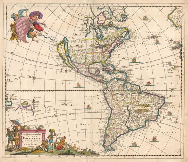
This handsome map of the Americas is derived from the maps of Nicolas Visscher and Frederick de Wit. The island of California and the Great Lakes are shown on the Sanson model. Above California is the Fretum Aniani and Terra Esonis. In the Southwest, the Rio del Norto flows from a large interior lake and empties into the sea between the mainland and California. In South America, Parime Lacus is prominent and a battle scene and village appear in the Brazilian interior. The map is embellished with two large cartouches that were also copied from Visscher. The top cartouche depicts angels struggling with a devil for the soul of a Native American. The pictorial title cartouche contains scenes of gold panning, hunting and a native chief standing beneath an umbrella. Numerous galleons sail the oceans and a variety of wildlife roam the interior of North America. This is the second state with the new information concerning discoveries in the South Pacific.
References: McLaughlin #75.
Condition: B
Old paper repairs on marginal fold separations. Some minor stains at right and some bleed through of color on verso.