Subject: Western Hemisphere
Period: 1639 (dated)
Publication:
Color: Hand Color
Size:
14.2 x 10.6 inches
36.1 x 26.9 cm
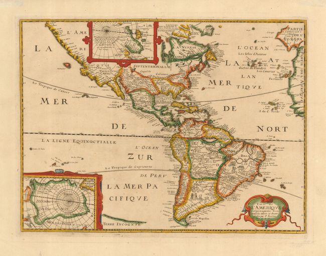
Extremely rare first state of a very scarce derivative of Hondius' influential map of 1618. This is a reduced version of a map of the same title by Petrus Bertius & Melchior Tavernier (1627). The map improves on Hondius by completing the coastline of Tierra del Fuego. California is still shown as a peninsula, although the Baja Peninsula is now isolated by two oddly crossed rivers, opening the possibility that it may be an island. The western cost of America is elongated and filled with place names, and there is a large inland sea in New Mexico. The Great Lakes are only suggested, and the region of New England is named Norumbega. South America has tiny engraved natives and trees, and two large lakes, Eupana and Parime are shown in the interior. There are insets of both the North and South Poles. The South Pole is a large continent, with two places noted; Beach Province, in reference to a place noted by Marco Polo, and Pays des Paroquets (Country of the Parakeets). The North Pole has the typical cartography of the time, with a bit of information from James and Hudson's expeditions shown.
References: Burden #256.1.
Condition: A+
Beautiful impression, attractive color and very generous margins. Hinge remnants on verso.