Subject: Canada
Period: 1597 (dated)
Publication: Descriptionis Ptolemaica augmentum
Color: Black & White
Size:
11.5 x 9 inches
29.2 x 22.9 cm
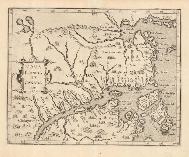
This map is cartographically important for a number of reasons: it is the first state of the plate, issued in the first atlas of the New World, the first map to use Canada in its title, and the first to concentrate on the St. Lawrence River and gulf. The general outline of the map is derived from Gerard Mercator and summarizes sixteenth-century knowledge of the region. The region north of the St. Lawrence and east of the Saguenai River is labeled Canada, and Nova Francia is centered on the town of Hochelaga (present-day Montreal).
References: Burden #102; Kershaw #35.
Condition: A
This is a fine, dark impression with a couple of professionally repaired, unobtrusive wormholes in the unengraved portion of the centerfold.