Subject: North America
Period: 1782 (dated)
Publication:
Color: Hand Color
Size:
19 x 19.5 inches
48.3 x 49.5 cm
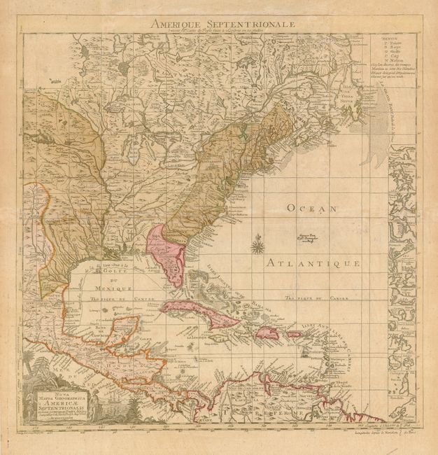
This is a scarce and unusual German variant of the key map for Henry Popple's seminal map of North America. Unlike the Dutch and French versions, this German edition contains a geographical difference from the British original - Lake Champlain has two branches on the south end instead of just one. The thirteen British colonies are clearly delineated, just one year before the formal peace treaty between the United States and Britain. At right is a column of inset maps including Boston, New York, Charlestown, St. Augustine, Bermuda and several others. Shows the Spanish galleons' route from Vera Cruz to Havana is marked. The pictorial cartouche features Native Americans. Title above map, "Amerique Septentrionale Suivant la Carte de Pople…"
References:
Condition: B
Original color, slightly faded, with light toning along fold.