Catalog Archive
Auction 117, Lot 823

"Carte Particuliere des Costes de l'Afrique Qui comprend le Royaume de Gualata &c", Mortier, Pierre

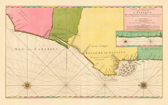
Subject: Africa - Western

Period: 1720 (circa)

Publication: Neptune Francois

Color: Hand Color

Size:
33 x 19.4 inches
83.8 x 49.3 cm
Download High Resolution Image
(or just click on image to launch the Zoom viewer)

A large and magnificent sea chart that details the coastline in the vicinity of the Western Sahara from Cape Boujdour to D'Arguin and the region near Nouakchott in Mauritania. The interior is blank with all details along the coastal areas. Arrayed with rhumb lines plus two compass roses beautifully highlighted in gold. Inset with a view of the southern extension of the coastline. A large and very striking chart printed on two joined sheets.

References:

Condition: A+

Truly gorgeous with a beautiful impression and old color highlighted with gold.

Estimate: $600 - $800

Sold for: $450

Closed on 12/6/2006

Archived