Subject: Africa - Northern & Western
Period: 1851 (circa)
Publication: The Illustrated Atlas
Color: Hand Color
Size:
13 x 10 inches
33 x 25.4 cm
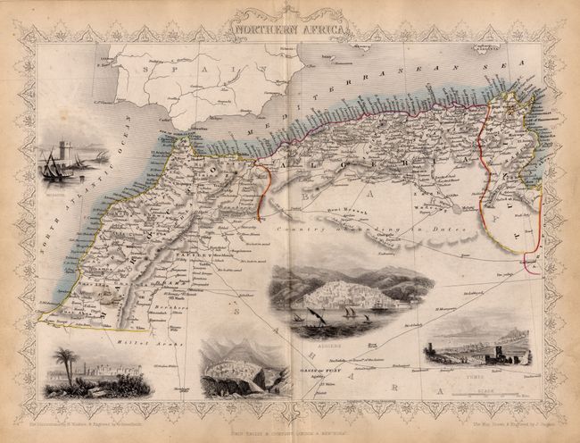
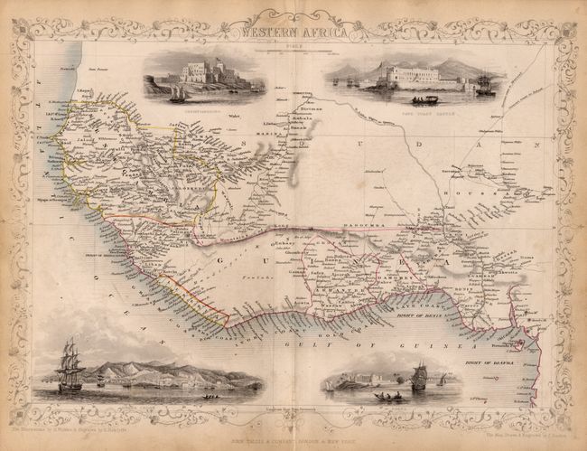
Good detail of the areas with the beautiful border associated with this series of maps. Drawn and engraved by John Rapkin. Northern Africa includes vignettes of a Mogador, Morocco, Constantine, Algiers and Tunis and depicts many caravan routes. Western Africa extends from Senegal to the Bight of Biafra and has vignettes of Christiansborg, Cape Coast Castle, Bakel, and Sierra Leone. Liberia had just become a free country in 1847, and is here named. The coast also shows the names of theSlave Coast, Grain Coast and Windy Coast in addition to the Ivory and Gold Coasts.
References:
Condition: A
Light toning and soil, still all over very good. Western Africa with minor fold separation at bottom Original outline color.