Subject: Africa
Period: 1794 (dated)
Publication:
Color: Hand Color
Size:
21 x 17 inches
53.3 x 43.2 cm
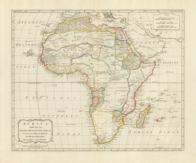
This lovely map of the continent presents the political boundaries, rivers, deserts, and trade routes. The interior is mostly blank with some notations. The Nile still originates in the twin lakes above the Moon Mountains, here erroneously called the Limar Mts. The map extends to include Madagascar, Bourbon I., and the Canaries and Cape Verde Isles in the Atlantic. Locates many countries including Negroland, Ethiopia, Magadoxa, the region of Hottentots, and much more. Published by Laurie & Whittle, No. 53 Fleet Street.
References: cf Rumsey 2523 (larger edition).
Condition: A
A very fine example with strong color and impression printed on thick hand laid paper with wide margins. Huge watermark features a crown and fleur-de-lys. Small amount of foxing in margin at lower left, else fine.