Subject: Near and Middle East, Cyprus
Period: 1507 (published)
Publication: In Hoc Operae Haec Continetur Geographia Cl. Ptholemaei
Color: Hand Color
Size:
21 x 14.5 inches
53.3 x 36.8 cm
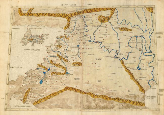
This extremely rare map was printed by Bernard Venetu de Vitalibus from the same copperplate as the 1478 edition. The map shows the eastern Mediterranean and the Middle East from Cyprus to Babylon and the Persian Gulf. It covers the Roman provinces of Syria, Palestine, Arabia Petrea, Arabia Deserta, Babylonia and Mesopotamia. The rope-like mountain ranges and prominent rivers are typical of the early Ptolemaic maps. The map is made up of two joined sheets.
References: Laor # 605; Mickwitz, Miekkavaara & Rantanen (Nordenskiold) #202-25.
Condition: B
Early color with slight overall oxidation. There are a couple of areas of small loss along the center joint.