Subject: Asia
Period: 1710 (circa)
Publication:
Color: Hand Color
Size:
13.5 x 11.3 inches
34.3 x 28.7 cm
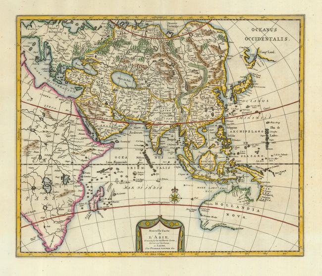
This is a very uncommon map of Asia, expanded to show most of Europe and Africa and the known parts of Australia. The outline of Asia is based primarily on Hondius' important map of the continent except that Korea appears correctly as a peninsula. The partial coastlines of Yedso and Comps. Land are shown above Japan. The map extends to include all of the East Indies and New Guinea with the Dutch discoveries on the Carpentaria coastline. The place names along the northern coastline of Australia reflect Dutch discoveries including Carstensz (1623), Pool & Pietersz (1636) and Tasman (1644). The southwestern coastline reflects the accidental discoveries of the VOC ship, the Leeuwin, in 1622.
References:
Condition: A+