Catalog Archive
Auction 117, Lot 527

"[Lot of 2] Gravelinga Gallis Gravelines Dicta [and] Duynkerck Vulgo Duynkerke", Blaeu, Johannes
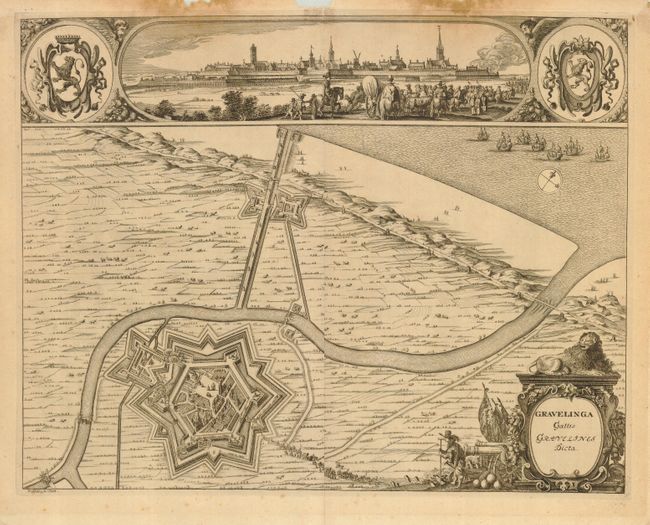
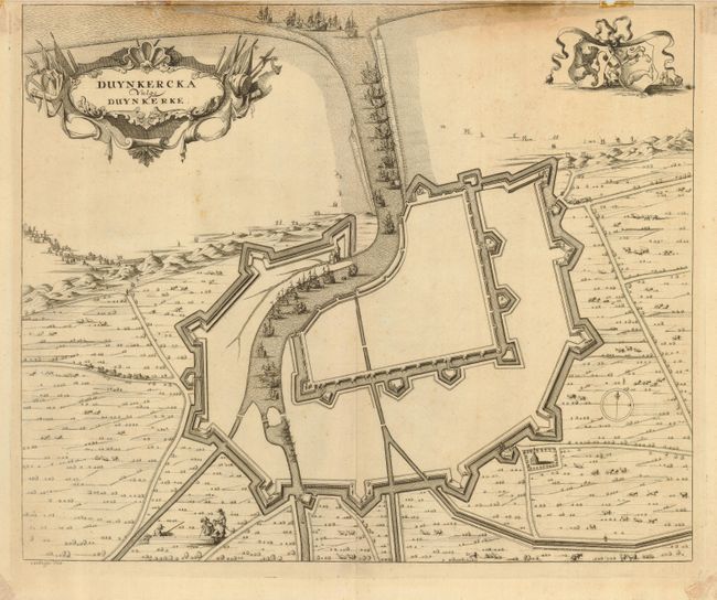
Subject: France

Period: 1649 (circa)

Publication: Tooneel der Steden van ver Vereenighde Nederlanden

Color: Black & White

Size:
19.5 x 15.5 inches
49.5 x 39.4 cm
Download High Resolution Image
(or just click on image to launch the Zoom viewer)

Two graphic plans from Blaeu's townbook of the southern Netherlands, first published in 1649. Blaeu published the townbook towards the end of the conflict with Spain and consequently the atlas became linked with the Dutch struggle for independence. These plans depict strategic fortified cities located in the southern Netherlands that were controlled by the Spanish and are now located in France. The plan of Gravelines includes a view at top. Both are richly embellished with elaborate cartouches, sailing ships and coats of arms. Engraved by R. Blokhuyse. Sizes vary slightly.

References:

Condition: C

Both with stains and paper damage at top. While presentable as is, they would benefit from professional conservation.

Estimate: $200 - $250

Sold for: $150

Closed on 12/6/2006

Archived