Subject: Scotland
Period: 1654 (circa)
Publication: Atlas Novus
Color: Black & White
Size:
22 x 16.5 inches
55.9 x 41.9 cm
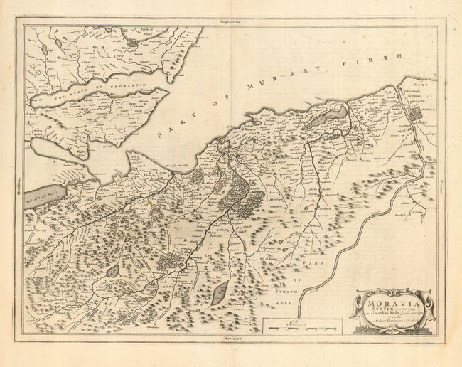
A beautiful map based on the manuscript drafts of Timothy Pont and the revisions of Robert Gordon. The area described shows Inverness and most of the counties of Nairn and Elgin. Also noted is Loch Ness, the Firths of Cromarty and Moray (north part). Dutch text on verso. Timothy Pont surveyed Scotland in the 1580's and 1590's, but his maps were not published in his lifetime. Robert Gordon took the mapping done by Pont and clarified them , and passed the maps onto Joan Blaeu, who published them in his 1654 Atlas Novus. These maps formed the basis for the cartography of Scotland for the next one hundred years.
References:
Condition: A
Nice and crisp with a few spots of light foxing and an old paper repair on centerfold.