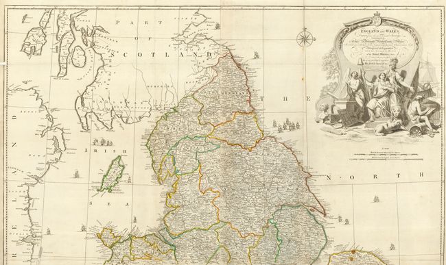
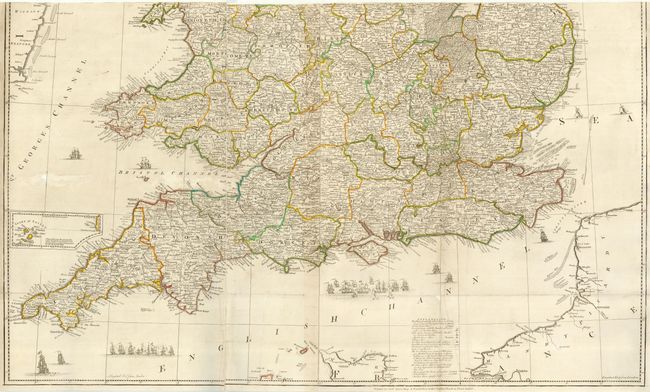
Subject: England & Wales
Period: 1761 (circa)
Publication: General Atlas
Color: Hand Color
Size:
39 x 46 inches
99.1 x 116.8 cm
Large and magnificent four sheet map filled with remarkable details down to the smallest village. The map shows hundreds of roads with distance information between towns. The legend identifies numerous physical features through icons for towns and villages by size, local markets, astronomical observation sites, and more. Large title cartouche with fancy lettering depicts Britannia, a lion with trident, surveying instruments, a globe, etc. The seas are embellished with numerous sailing ships and a fine compass rose. With the imprint of Robert Sayer Map & Printseller at the Golden Buck in Fleet Street. As issued with two sheets joined to form a two-part map. When top and bottom are joined, the map will measure approximately 39 x 46".
References: Rumsey #2594 (southern sheet only).
Condition: B
Crisp impression and fine hand coloring in outline. A couple spots and a little toning along some folds & a few flaws at fold intersections, but near very good. Backed with Japanese paper.