Subject: England & Wales
Period: 1613 (circa)
Publication:
Color: Hand Color
Size:
18 x 13.8 inches
45.7 x 35.1 cm
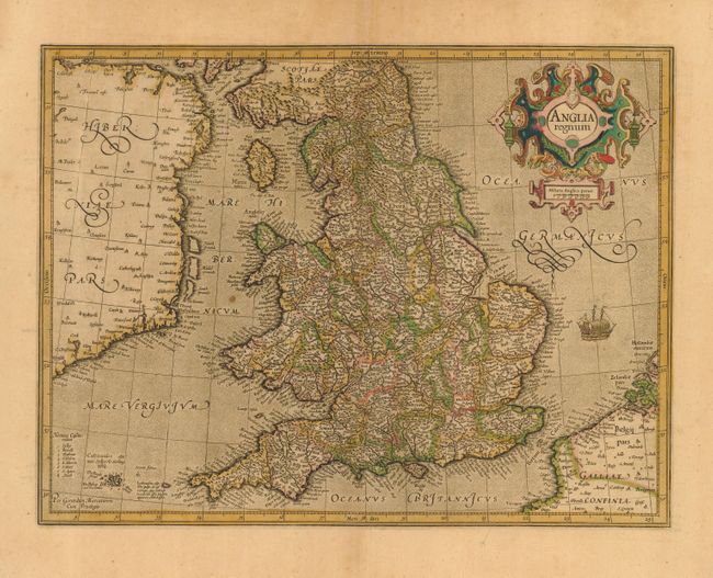
This attractive map of Elizabethan England is filled with names taken from Saxton's map of 1579. County boundaries and the Latinized names of counties are shown. The map is beautifully engraved in Mercator's characteristic style with a stipple engraved sea with a sailing ship, bold calligraphy and a handsome title cartouche. French text on verso.
References: Shirley (BI) #181; Van der Krogt (Atlantes) #5100:1A.1.
Condition: A
Toned with attractive original color. A small hole in the lower right margin, well away from the map. One spot in the Irish Sea, still overall very good.