Subject: Atlantic Ocean
Period: 1647 (circa)
Publication: Dell' Arcano del Mare
Color: Black & White
Size:
29.5 x 19 inches
74.9 x 48.3 cm
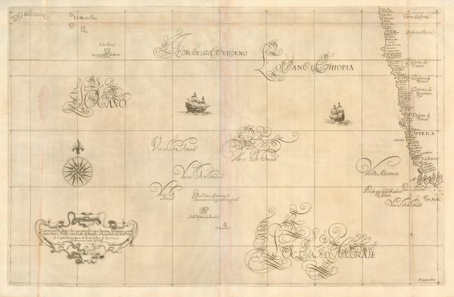
This handsome sea chart is from the first atlas to print all maps on Mercator's Projection, the first to show winds, currents and magnetic deviation on its maps, and the first atlas of sea charts by an Englishman. This chart covers the South Atlantic including the southwest tip of Africa, Tristan da Cunha, Ilha de Trinidade and Ilhas de Martin Vaz. Dudley, a skilled mathematician and navigator, was exiled from England and settled in Florence where his atlas was published. The chart, beautifully engraved by Antonio Lucini, is embellished with a title cartouche, large compass rose, two sailing ships and graceful calligraphy. Two sheets, joined, as issued.
References:
Condition: B
Toned on joint and outside folds, else very good.