Catalog Archive
Auction 117, Lot 41

"A New & Accurate Map of the North Pole with all the Countries hitherto Discovered Situated near or adjacent to it as well as some others more Remote…", Bowen, Emanuel
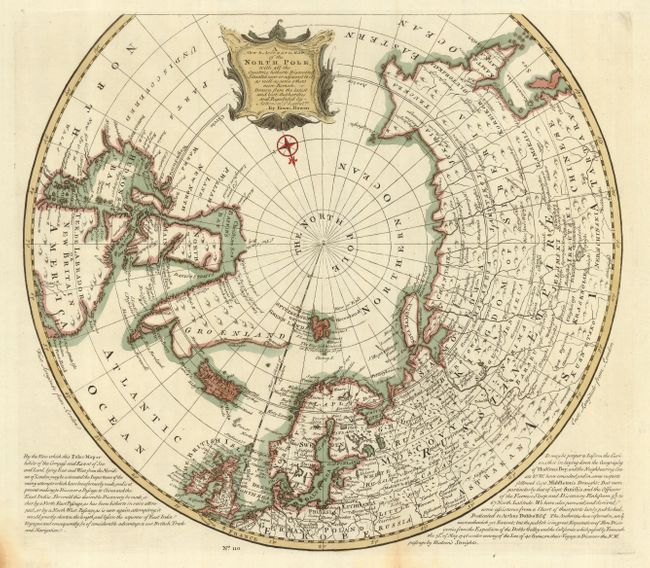
Subject: North Pole

Period: 1747 (published)

Publication: A Complete System of Geography

Color: Hand Color

Size:
16.5 x 14.8 inches
41.9 x 37.6 cm
Download High Resolution Image
(or just click on image to launch the Zoom viewer)

Handsome polar map covering the region north of 50 degrees. It contains numerous notations concerning recent discoveries and the entire western part of North America is labeled Parts Undiscovered. There is also a notation of a Newly Discover'd Sea in Hudson's Bay that is totally fictitious. At bottom are lengthy English text panels describing the possibilities of still discovering northeast and northwest passages to Asia. Nicely decorated with a title cartouche and compass rose. This is the first state of this map.

References: Phillips (A) #603-70; Kershaw: #419.

Condition: A

Very good impression with nice coloring. There are folds as issued, with a tiny bit of fold separation and a little toning in the bottom.

Estimate: $400 - $500

Sold for: $230

Closed on 12/6/2006

Archived