Subject: Hispaniola
Period: 1740 (circa)
Publication:
Color: Hand Color
Size:
24 x 18.3 inches
61 x 46.5 cm
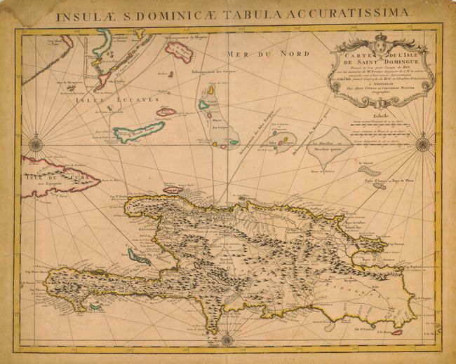
This is an important map of Hispaniola and the Turks & Caicos Islands. When initially published in 1722 by Delisle it was one of the first to depict the island's true contours following Frezier's important map of the island. The chart provides excellent detail of the three districts showing mountains, roads, towns, ports, plantations, sugar works and navigational hazards. Decorated with a large title cartouche and compass rose. Latin title above, "Insulae S. Dominicae Tabula Accuratissima."
References:
Condition: C
Heavily toned along margins with a damp stain in the upper left blank margin. Margins a bit tattered with some chips and short tears. Centerfold separations at the top and bottom, the bottom one extends into the map about 2 inches. Still a striking map worthy of conservation.