Catalog Archive
Auction 117, Lot 379

"[Lot of 2] A New and Correct Chart of the Trading Part of the West Indies [with] The Atlantick Ocean describing the Coast from Oronoque River to Hispaniola with the Caribee Islands", Overton, Henry
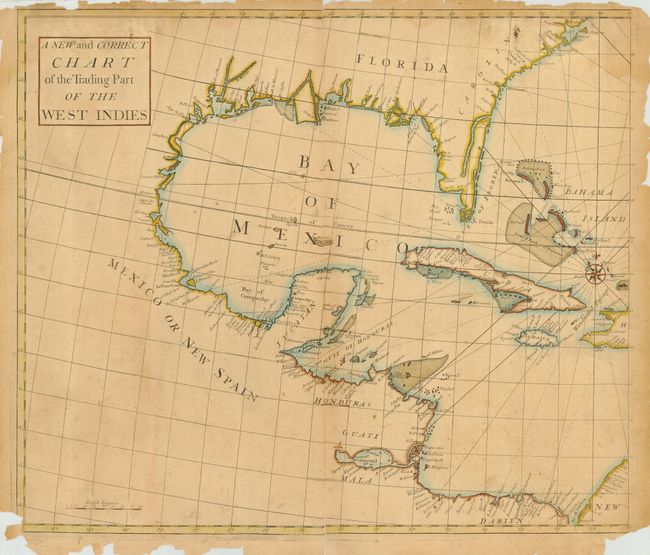
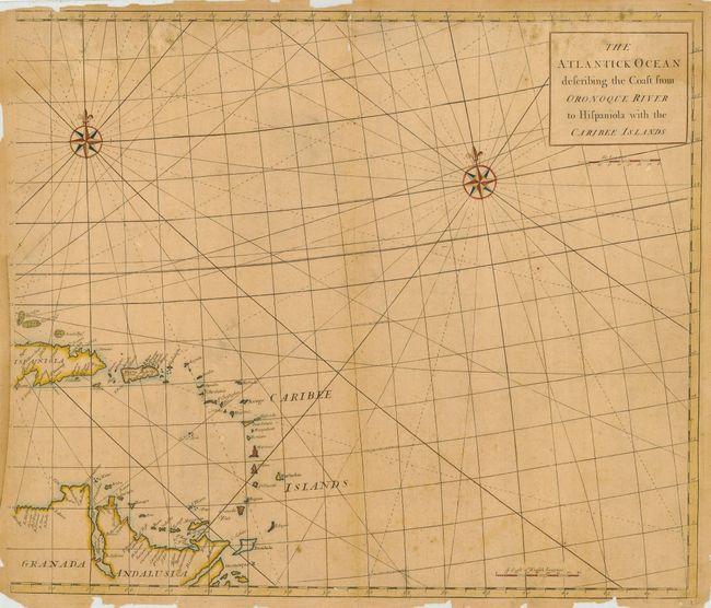
Subject: Caribbean

Period: 1745 (circa)

Publication:

Color: Hand Color

Size:
23.5 x 20 inches
59.7 x 50.8 cm
Download High Resolution Image
(or just click on image to launch the Zoom viewer)

Pair of scarce charts covering the West Indies from the Gulf Coast through the Caribbean Islands and the northern coast of South America. The Florida peninsula is depicted as several large islands. The maps provide excellent coastal and navigational information and no interior details. The charts combine to include three compass roses and rhumb lines.

References:

Condition: D

Toned with brittle and chipped margins with a few tears entering maps and a bit of loss of neatline. Both with long or complete separations at centerfold. Needs and deserves professional conservation.

Estimate: $300 - $500

Sold for: $500

Closed on 12/6/2006

Archived