Subject: United States & Mexico
Period: 1584 (published)
Publication: Theatrum Orbis Terrarum
Color: Hand Color
Size:
8.8 x 13 inches
22.4 x 33 cm
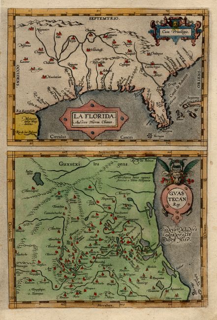
This is the right-hand sheet of Ortelius' group of maps based on Spanish sources; in this case drawn from reports of Hernando de Soto's expedition through the region. The most important map (La Florida) is the first printed map of the southeastern portion of the United States. This influential map provided the foundation cartography for the region, particularly in the depiction of the river system. The map was drawn by Geronimo de Chaves, Cosmographer Royal to Philip II of Spain. The second map (Guastecan Reg) combines with La Florida to extend the coastline of the Gulf of Mexico further south into present day Mexico. Blank verso.
References: Burden #57; Van den Broecke #15.
Condition: A
Some soil and short tears in margins, not affecting maps.