Subject: Wisconsin
Period: 1870 (dated)
Publication:
Color: Hand Color
Size:
30 x 33 inches
76.2 x 83.8 cm
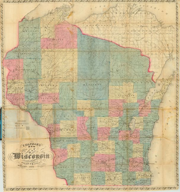
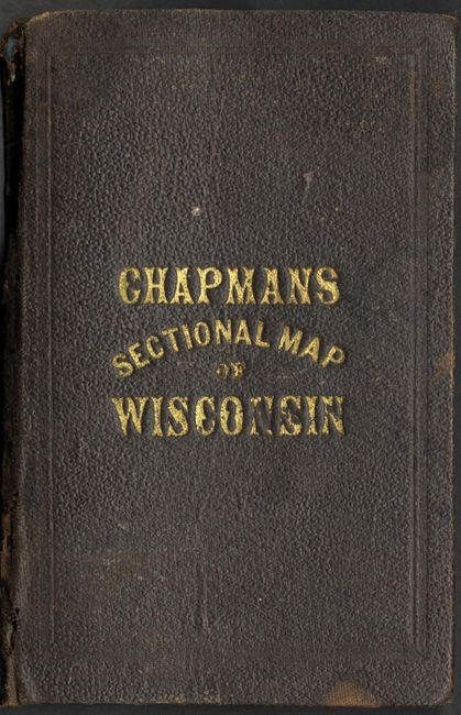
This is a rarely seen pocket map of Wisconsin that was produced and lithographed in Milwaukee. Printed on fine banknote quality paper and hand colored by county, this large folding map is drawn on a scale of 10 miles to the inch and thus contains a wealth of information. The southern portion is well settled with good detail of towns and villages, roads, and more. The railroad network is well developed in the south with the northernmost railroad completed near the town of Lincoln in Eau Claire county. The northern part of the state is mostly unsettled. The Chippewa Indian Reservation on Lake Superior and the Oneida Indian Reservation to the southwest of Green Bay are located. The map carries the copyright date of 1860; this being the updated edition of 1870 as noted in the title. There are just a few maps listed in Phillips from this period, and this one is not among them. Folds into brown cloth covers ( 4"x 6") with gilt title. Paper label on inside lists other maps published by Silas Chapman.
References:
Condition: B
The map has a little foxing and fold toning with some fold intersections reinforced on verso with archival tape. The covers exhibit typical rubbing with a few stains and some small holes along the spine.