Catalog Archive
Auction 117, Lot 343

"Extract of Military Map of N.E. Virginia Showing the Forts and Roads", U.S. War Dept.

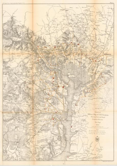
Subject: Virginia and District of Columbia

Period: 1865 (dated)

Publication: 39th Cong., 1st Session. Report of the Chief Engineer

Color: Printed Color

Size:
16.8 x 23.7 inches
42.7 x 60.2 cm
Download High Resolution Image
(or just click on image to launch the Zoom viewer)

This is an unusual map that shows the District of Columbia and street grids for Washington and Alexandria. Many of the forts and roads within the District are shown in color. The information shown is very detailed, including forested areas and farmsteads. This is an important map for understanding the field of operations in northeast Virginia during the Civil War. It is the most interesting of the 14 maps included in the report of the Army Chief of Engineers.

References:

Condition: B

These maps are often in bad shape - this one is in exceptionally good shape with minor toning on centerfolds. Issued folding, now pressed and backed with tissue.

Estimate: $350 - $400

Sold for: $550

Closed on 12/6/2006

Archived