Subject: Virginia
Period: 1862 (dated)
Publication: Pope's Report to the Committee on the Conduct of the War
Color: Black & White
A fascinating set of Civil War battle maps produced by Maj. Gen. John Pope for his contribution to the 1863 report to Congress's Joint Committee of the War Department. Each map is detailed to show troop positions and movements.
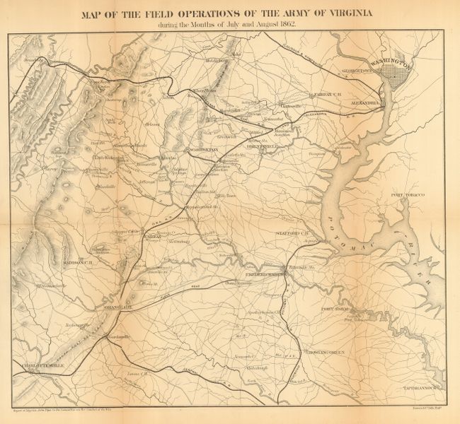
1) "Map of the Field Operations of the Army of Virginia During the Months of July and August 1862" (16.5 x 14.3"). The largest map in the set, it shows the area from Charlottesville to Washington, D.C. Locates Fort Tobacco, Port Royal, Bowling Green, Strassburg, and names the Manassas Gap, Loudoun & Hampshire, Central, and O & A Railroads. Long fold separation.
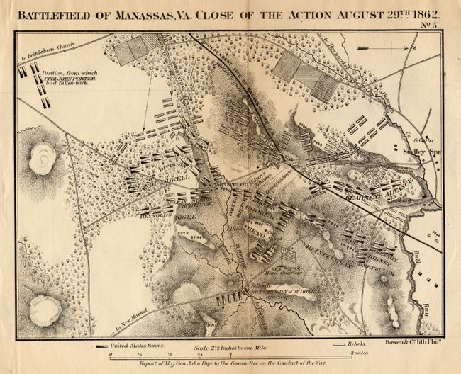
2) "Battle of Manassas, Va. Close of the Action August 29th 1862" (8.8 x 6.3"). This fully engraved map is filled with information and centered on Groveton. Also locates Sudley Springs, Mrs. Henry's house, Bull Run River, the toll gate on the road to New Market and Gen. Pope's Head Quarters.
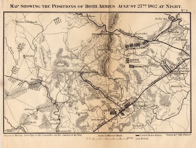
3) "Map Showing the Positions of Both Armies August 27th 1862 at Night" (9 x 5.8"). This map is centered on Warrenton and also locates Thoroughfare Gap, White Plains, Waterloo, Fayetteville, Germantown, New Market, etc.
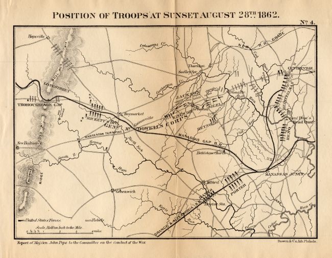
4) "Position of Troops at Sunset August 28th 1862" (8.8 x 6.2"). Centered roughly on Gainesville it extends to include Manassas Junction, Centerville, New Baltimore, Greenwich, Bristoe Station, and more.
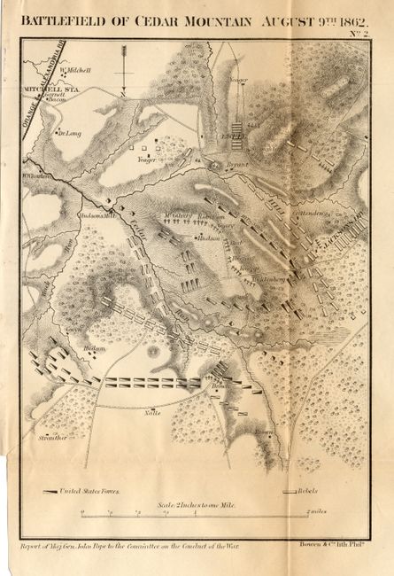
5) "Battlefield of Cedar Mountain August 9th 1862" (6.1 x 8.8"). Mountains and hills shown via hachure. The map locates Mitchell Station, and the houses of Dr. Long, Garnett Bacon, W. Mitchell and Yeager, to mention a few.
References: Stephenson (CW) #526.5.
Condition: B
All with full margins and light toning along some folds.