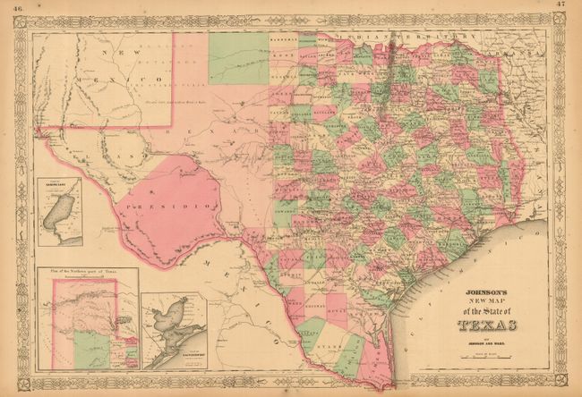
Subject: Texas
Period: 1863 (published)
Publication: Illustrated Family Atlas of the World
Color: Hand Color
Size:
24 x 17 inches
61 x 43.2 cm
Large, handsome map with county development mostly in eastern Texas and only the three large counties of El Paso, Presidio, and Bexar in the west. The panhandle, noted as the Staked Plains (Elevated Table Land, without Wood or Water), includes a large section that is unorganized. Nice depiction of the wagon roads, many named, with several completed railroads. Insets include a Plan of Sabine Lake, Plan of the Northern part of Texas, and Plan of Galveston Bay. Decorative latticework border. Text on verso.
References:
Condition: A
Very nice example with professionally applied tissue at margins and centerfold on verso. Lovely, even ivory age toning. Full margins and original hand coloring with dark impression. A well cared for map.