Subject: Texas
Period: 1856-70 (dated)
Publication:
Color: Hand Color
Historical lot that shows the region and its settlement and development between the 1850's and about 1870.
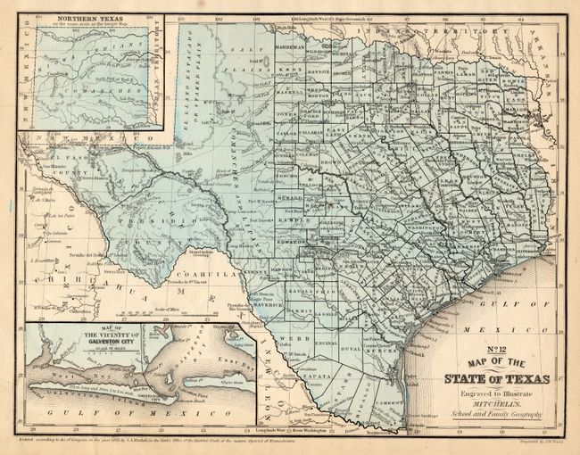
1) This map is from S.A. Mitchell's School and Family Geography, 1858, (10.5 x 8.1"). It is a great little map that is filled with a remarkable amount of information considering that it came from a school atlas. Details include Indian tribes, watershed, counties, cities and towns, wagon roads or trails, and more. There are no counties formed west of about the 100th meridian. The large El Llano Estacado is completely unorganized to the Rio Grande. The Salt Plains lay to the east of the Staked Plain. Hills are shown through hachure. With insets of the panhandle and the vicinity of Galveston. Earlier editions of this map are titled "No. 13…"
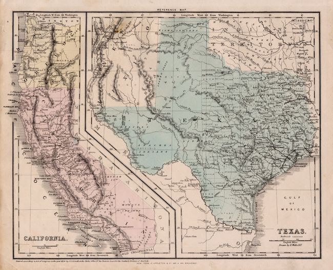
2) This map is by D. Appleton & Co, published in 1856, (12.5" x 10"). A smaller map of California is printed on the same sheet. The Texas county organization is nearly identical to the first map, except the Staked Plain region is labeled Bexar. The entire western portion and part of New Mexico are called High Arid Tablelands.
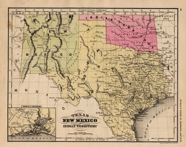
3) The final map includes all of Indian Territory and New Mexico. It was published circa 1870 in McNally's System of Geography as Map No. 19. The counties are not named, but have numbers, obviously referred to the geography's text. With an inset of the Vicinity of Galveston. Drawn and engraved by Oliver Stuart, (10.8 x 8.5").
References:
Condition: A
All are very good to fine. The second map has one spot at lower left in California.