Subject: Texas
Period: 1855 (dated)
Publication: General Atlas
Color: Hand Color
Size:
25 x 16 inches
63.5 x 40.6 cm
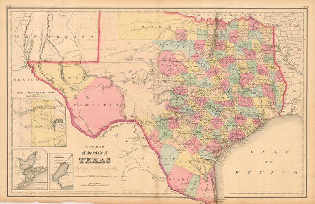
This double-page map shows extensive detail throughout the settled part of the state. The western third is comprised of the large unsettled areas of Presidio, El Paso, Bexar and the Staked Plain. Also a large unorganized area called Cooke extends westward from Cooke County (organized in 1849) well into the Staked Plain. Locates railroads, forts, post offices, roads, springs, and topographical detail. Three insets: "Plan of the Northern Part of Texas," "Plan of Galveston Bay from the U.S. Coast Survey," and "Plan of Sabine Lake." A handsome sheet with fancy titling.
References:
Condition: B
Original coloring and margins with fine impression. A little toning along centerfold and a little roughness at margin edge at lower left, else very good.