Subject: Oklahoma
Period: 1889-1901
Publication:
Color: Printed Color
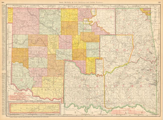
1) Rand, McNally & Co.'s Oklahoma and Indian Territory is a wonderful, transitional map showing the newly-created Oklahoma Territory co-existing with Indian Territory. In 1907 these territories would be joined to become the new state of Oklahoma, which was commemorated in a symbolic wedding ceremony at the courthouse. This map dates to 1901 from its county configurations. It provides railroad information, printed in red, and is filled with details both on the map and printed on the verso (26 x 19").
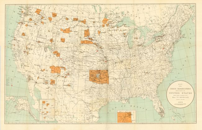
2) Map Showing Indian Reservations within the Limits of the United States Compiled under the Direction of T. J. Morgan , Commissioner of Indian Affairs. This is a map showing the location of all of the Indian reservations present during 1889. What would become Oklahoma is primarily Indian Territory at this time, with just a tiny Oklahoma shown within it. The panhandle is not yet part of Oklahoma. Red stars note the Indian Training Schools. Published by the U.S. Bureau of Indian Affairs (33.2 x 21").
References:
Condition: A
1) Attractive and colorful map lightly toned with a couple soft creases.
2) With folds as issued, some tiny fold separations and one tear on binding edge in blank margin. One dog-eared corner.