Subject: New York
Period: 1839 (circa)
Publication:
Color: Black & White
Size:
10.5 x 15 inches
26.7 x 38.1 cm
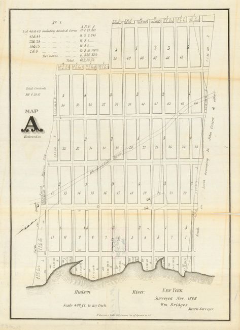
This map shows a portion of Manhattan that was surveyed by Wm. Bridges in November of 1808. Drawn on a scale of 400 ft. to an inch. Although the survey was done in 1808, this map was not published until circa 1839. It is in fact, a very early lithographic work by Nathaniel Currier and bears his pre-Currier & Ives imprint "N. Currier's Lith. 152 Nassau Cor. of Spruce St. N.Y." The map shows adjoining land ownership, the Hudson River, and with the planned Bloomington Road (now Broadway) shown as a dotted line. This seldom seen chart is a very early stone lithograph by the famous Mr. Currier.
References:
Condition: C
Printed on thin paper and issued folding. Two fold separations on one side with slight loss and toned on two folds. Stamp and ink notation on verso with slight show through.