Subject: Massachusetts, Boston
Period: 1910 (circa)
Publication:
Color: Printed Color
Size:
15.8 x 19 inches
40.1 x 48.3 cm
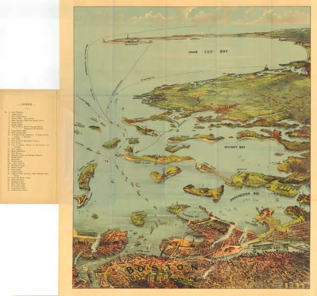
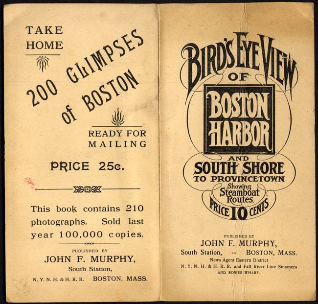
A terrific bird's-eye pocket map produced for the tourist trade. The attractively colored map folds into paper covers with title and the price - 10 cents. The map extends from South Bay all the way to Cape Cod Bay and Provincetown. This early edition does not have the numerical key listing at bottom (see Auction 114-242). This edition names 35 landmarks and lighthouses, all keyed to the map. Numerous ferry and ship routes are shown. The map is beautifully printed as a chromolithograph with no credit given to the printing company. Published by John F. Murphy, News agent for the N.Y.N.H. & H.R.R. and Fall River Line Steamers.
References:
Condition: A+
Covers slightly soiled or toned. The map is fine with strong color. Two small areas of misfolding in blank right margin.