Subject: Hawaii - Oahu
Period: 1906 (dated)
Publication:
Color: Printed Color
Size:
33 x 27.5 inches
83.8 x 69.9 cm
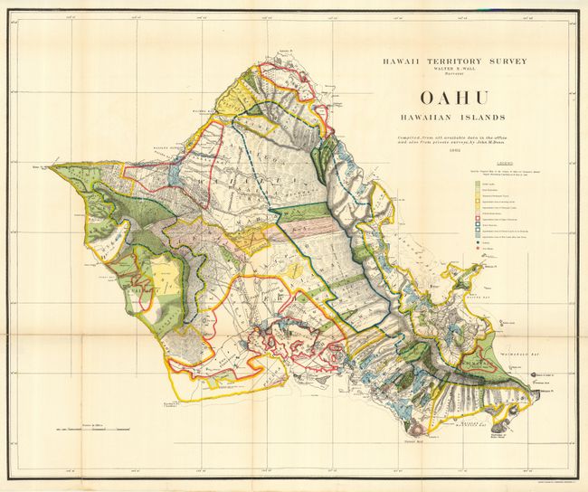
Brilliantly colored and detailed map of Oahu with much information on pineapple and sugar plantations, homesteads, public lands, Crown lands and public buildings. The areas of Diamond Head, Koko Head and Kailua Bay are described as well as the charmingly-named Cocoa-Nut Grove on Maunaloa Bay, complete with tiny coconut trees. Hawaii's monarchy was overthrown in 1893, and this map was prepared for the Governor's Annual Report of 1906. The governor at this time was George R. Carter.
References:
Condition: A
Issued folded, now pressed and professionally backed with Japanese tissue. This map is near fine with the exception of some light toning on folds.