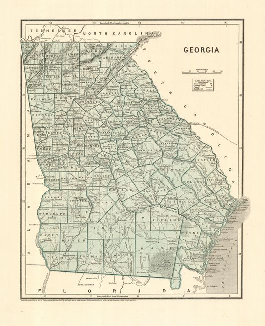
Subject: Georgia
Period: 1842 (dated)
Publication: Morse's North American Atlas
Color: Printed Color
Size:
11 x 14 inches
27.9 x 35.6 cm
An early printed color map that covers the state in fine detail including the major roads, the new Chattanooga to Savannah Railroad and Forts Walker and Gilmer in the Okefinokee Swamp. Legend keys to the capital, towns, canals, and railroads. The map was produced with the cerographic process, one of the earliest methods used for color printing in maps. It proved to be too expensive at the time it was introduced by Morse & Breese and did not come into general usage until the later part of the nineteenth century.
References: Philips (A) #1228-18.
Condition: A+
Very nice example with fine coloring and impression, and full margins.