Subject: Florida
Period: 1882 (published)
Publication: Sen Ex Doc No. 189, 1st Sess., 47th Cond.
Color: Black & White
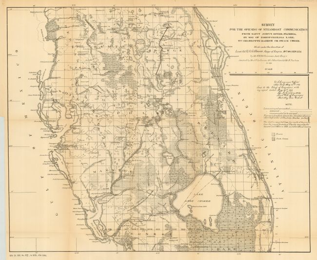
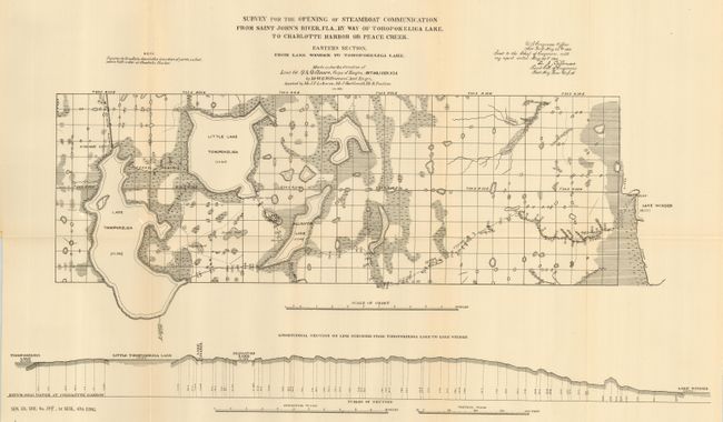
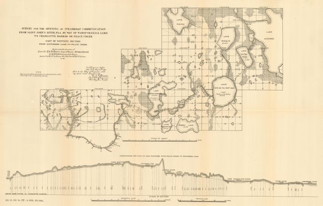
The first map shows in detail the overall canal project with the planned waterways shown via various types of lines. The map extends from Lake Okee Chobee northward to above Sanford and from coast to coast. Good detail of Tampa Bay and of the forts, settlements, rivers and lakes, and a railroad between Kissimmee and Sanford with the track passing through Orlando. Also delineates the routes of numerous prior explorations (20.8 x 17"). The Eastern sheet provides increased detail of the area from Lake Winder to Lake Tohopokeliga, showing Little Lake Tohopokeliga, and Alligator Lake. Along the bottom is an elevation section view of the planned route (21.5 x 12"). The third map covers the proposed waterway from Kissimmee Lake to Peace Creek. The route includes the lakes of Kotsa, We-Oh-Ya-Rap-Kah, Lenore, Little Tiger, Buffum and several others. It also features an elevation section view along the bottom (21.5 x 13"). All three maps are signed in the plate by Q.A. Gillmore, Lieut. Col. of Engineers and were prepared by Mr. W.G. Williamson.
References:
Condition:
The latter two maps are very good or fine while the first one has a little fold toning and is only good. All folded, as issued.