Subject: District of Columbia
Period: 1880-81 (published)
Publication:
Color: Printed Color
Size:
27.5 x 28 inches
69.9 x 71.1 cm
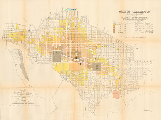
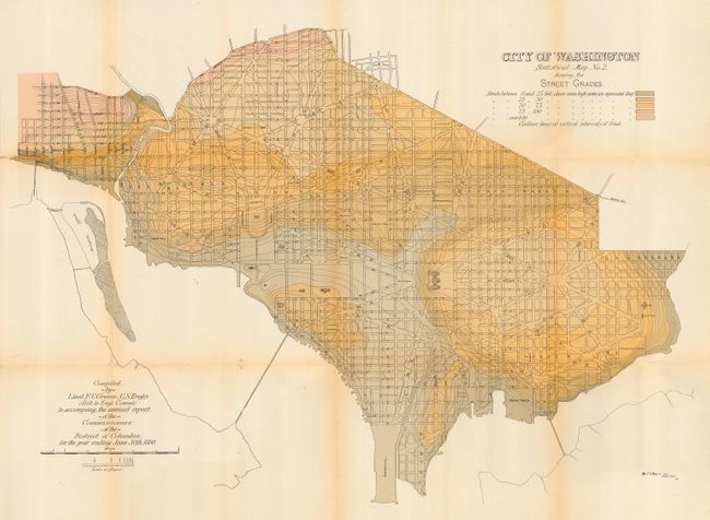
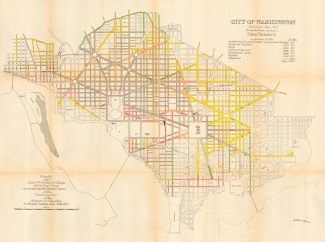
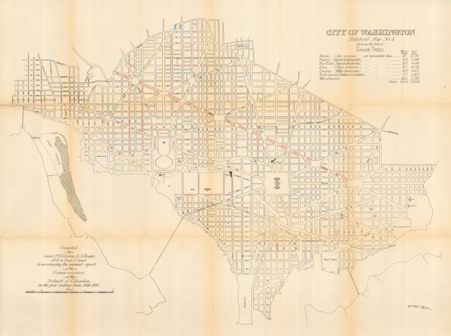
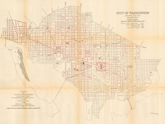
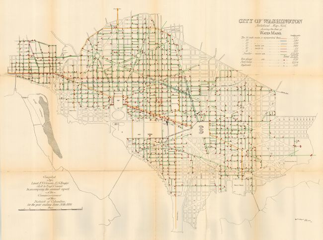
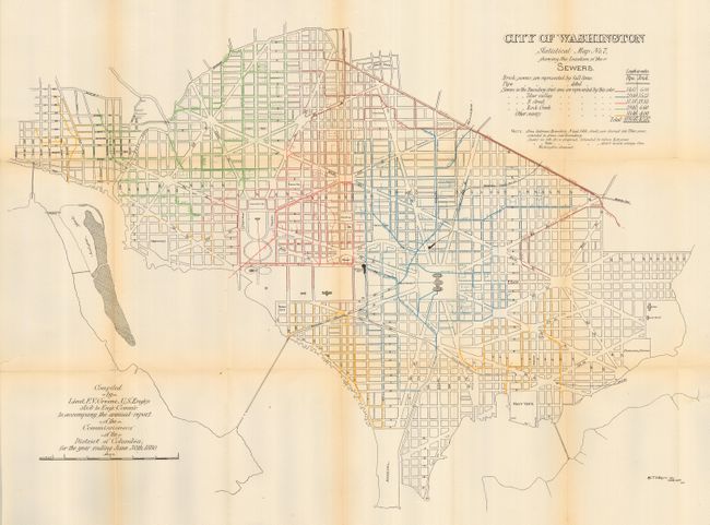
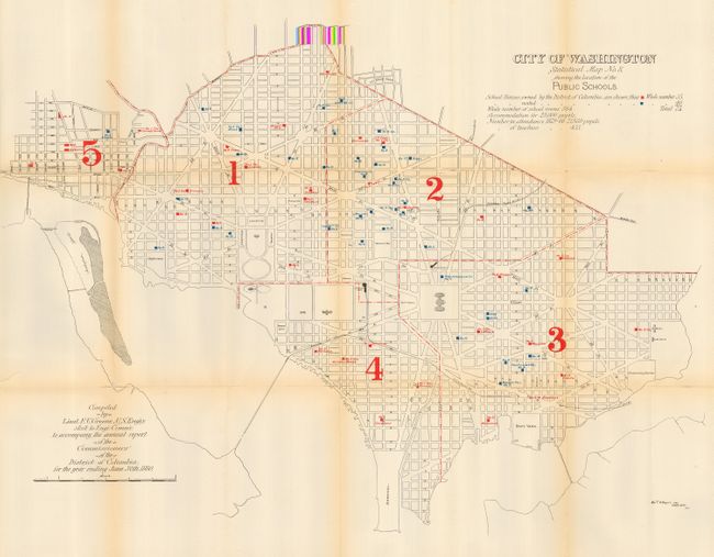
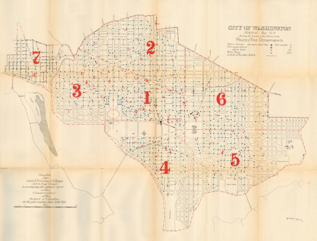
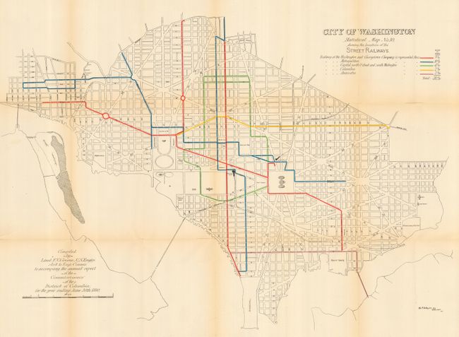
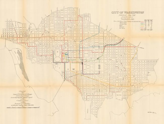
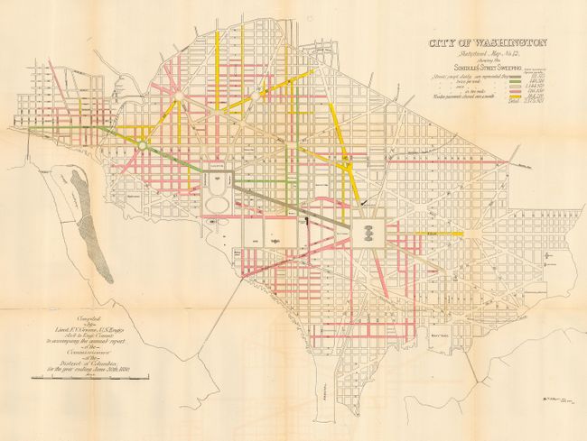
First edition and a complete set of the twelve original Greene maps published to show the large-scale improvements in the infrastructure of the city. These maps were prepared by Capt. W.T. Rossell of the Army's Corps of Engineers to accompany the annual report of the Commissioners, District of Columbia. Each map carries the title "Statistical Map No.__," and is drawn on an identical scale and shows the street pattern of Washington. Each has a specialized focus, e.g. valuation of real estate, street grade, varieties of street pavements, shade trees, sewers, water supply and distribution, street lamps, public schools, police and fire department stations, street railways, scheduled street sweeping, and underground cables. Very interesting details emerge from the maps, e.g., there were 1266 telegraph poles with 30.5 miles of line and 436 miles of wire; New Jersey Ave. was paved with wood and swept once each month. An important and complete set of twelve matched maps in their first edition that provide a remarkable look into the capital's infrastructure in the early 1880's.
References:
Condition: B
All have good impressions, full color and full, original margins. Printed on thick paper, which has led to the occasional fold intersection split. Very lightly toned on some folds, else very good to fine.