Catalog Archive
Auction 117, Lot 219

"Survey of Routes from the Valley of the Mississippi to the Pacific Ocean", U.S. Corps of Engineers

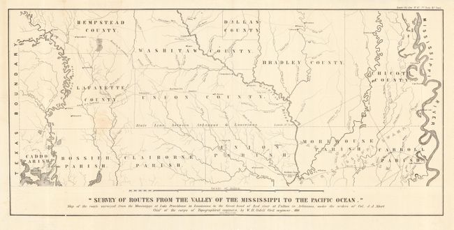
Subject: Arkansas and Louisiana

Period: 1850 (dated)

Publication: Sen. Doc. 42, 31st Cong. 2nd Sess.

Color: Black & White

Size:
30.5 x 15 inches
77.5 x 38.1 cm
Download High Resolution Image
(or just click on image to launch the Zoom viewer)

Subtitled, "Map of the route surveyed from the Mississippi at Lake Providence in Louisiana to the Great bend of Red river at Fulton in Arkansas, under the orders of Col. J.J. Abert Chief of the Corps of Topographical Engineers, by W.H. Sidell Civil engineer." The map covers the counties along the border between the two states in great detail with early county and parish configurations. The Bastrop Claim is shown extending into Arkansas.

References:

Condition: A

Issued folding, now pressed with a faint stain, still overall very good.

Estimate: $140 - $180

Unsold

Closed on 12/6/2006

Archived